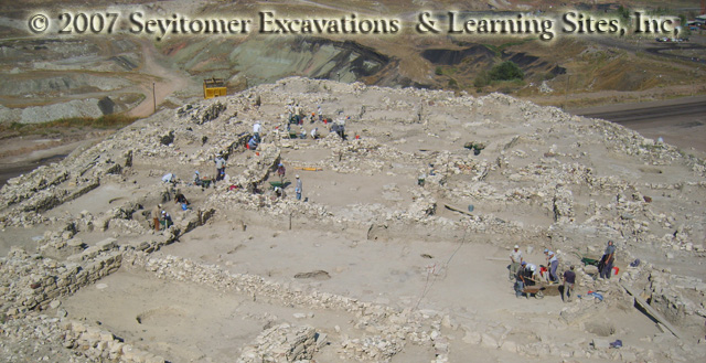
 At Seyitömer, the Hellenistic occupation (c.334-30 BCE) seems to have spread across the top of the mound and been enclosed by a fortification wall. Two phases have been detected, called the Early and Late Phases. The full extent of the settlement is still under investigation (see the progress photograph at the left, view generally eastward; hover over to enlarge).
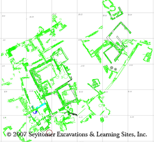 LEARNING SITES first worked with the CAD plans created at the site as the basis for building our 3D models of the mound and Hellenistic architecture (the CAD plan at the left was provided to us by the excavation team; hover over to enlarge).
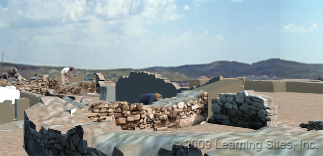
 Using photographs taken to our specifications, we textured the walls of our basic model and began to re-create the excavations as a living and entensible 3D document of the work, as a visualization to allow better understanding of the village, and as a prelude to publication (the preliminary view at the left, generally looking southward, shows our progress; hover over to enlarge).
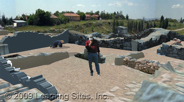
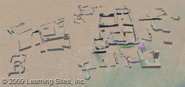
 We then output the 3D model using VRML to create an interactive, freely navigable virtual world of the Hellenistic period, constantly expanding as more excavated evidence came our way (the images at the left are screen grabs from the [unfinished]virtual world, as it was in 2009; hover over to enlarge).
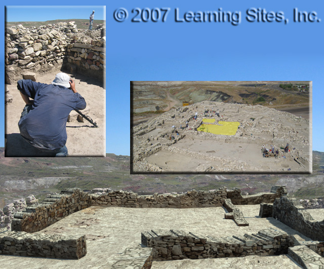 As we continued to map on excavation photographs to our 3D model and analyze the site plans, individual houses began to come into shaper focus. Several houses from Phase IIB (the earlier Hellenistic phase) have been uncovered, photographed, and modeled as excavated. From that data Learning Sites has created several as-built reconstruction models of this cluster of homes. One especially large house was uncovered near the top of the mound. At the left is a composite image showing the site photographer taking exacting wall photographs, an aerial view indicating the location of the house, and a rendering from the as-excavated VRML model of the house with the actual site photographs used to accurately texture each wall (view northish, over toward the courtyard; hover over to enlarge).
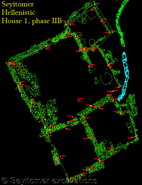 At the top of the mound stood a large courtyard house. Unfortunately, it was thoroughly rebuilt in the later Hellenistic phase, and this part of the mound was further disturbed in the Roman period. The house (called House 1; see the CAD plan at the left; hover over to enlarge) is c.20m x 12-16m in size and comprised of a courtyard, three rooms, and a conneting corridor. The foundation walls are c.80cm thick and preserved to a max. H of 1.50m; they are built of marl and limestone stones of greatly varying sizes. The courtyard is paved along its western edge and has an entrance in its west wall. Room 1 (in the NE corner) has pits in the floor evidently to hold storage jars. Room 2, in the SW corner, has an entrance in its southern wall.
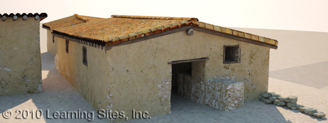
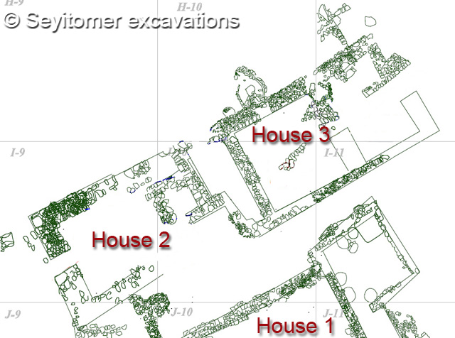 Just to the north of House 1 and across an alley stood two other houses (with a small space between them) that appear to have been constructed up against a fortification wall. House 2 is 5 x 17.6m and seems to have only a single room, with its entrance facing SW. House 3 is 5.5 x 20m and has two rooms, with its entry facing NE. The walls here are preserved to a height of 1m; and some plaster remains on the inside walls of the rear room (the excavation CAD plan of the area north of House 1 is at the left; hover over to enlarge). Renderings below are from our 3D model of the Hellenistic village, including all three houses; the top image is the village, the bottom one is the entrance to House 3; hover over to enlarge).