How Virtual Archaeology Envisions
the Ancient Near East

Presented on March 28, 2007, by Donald H. Sanders, PhD, for the Stigler Lectureship, University of Arkansas, Fayetteville, Arkansas, USA.

posted here October 16, 2019


 I. Introduction

My thanks and appreciation to the Department of Anthropology here at the University of Arkansas, and especially Prof. Kvamme and Prof. Kay, for inviting me here to speak to you this evening. I'll be speaking on a subject that meshes nicely with the topics presented by the other guests in this Lectureship series and one that I've been deeply involved with for well over a decade (that's nearly 1000years in computer terms), since the very beginnings of virtual reality in the early 1990s--that subject is: how we're using computer graphics to better document, understand, preserve, and protect the vast archaeological treasures of the ancient Near East.

this is meLet me begin by telling you a bit about who I am and what my companies do (see two iterations of my career at the left; hover over to enlarge). I have both an architecture and an archaeology degree, with a minor in architectural history. I've worked on excavations as a field architect in Greece, Saudi Arabia, and Turkey. While teaching archaeology, I noticed that students had a tough time deciphering ancient sites from photographs and drawings.

Tsoungiza, Greece, excavations
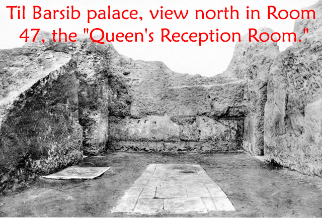
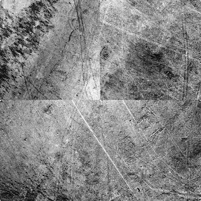
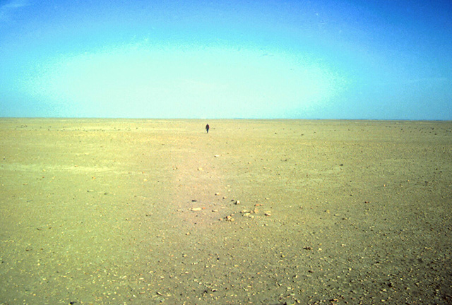
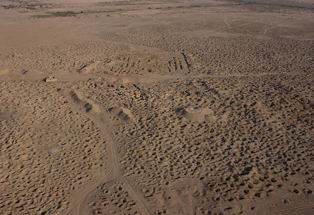
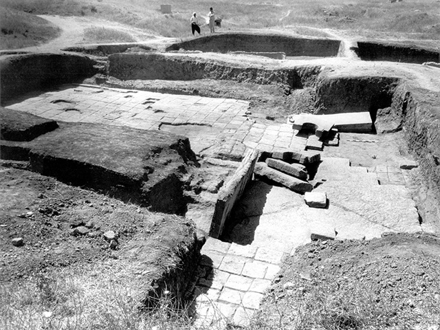
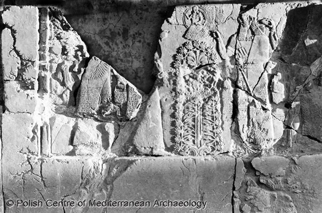
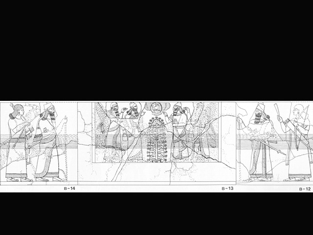
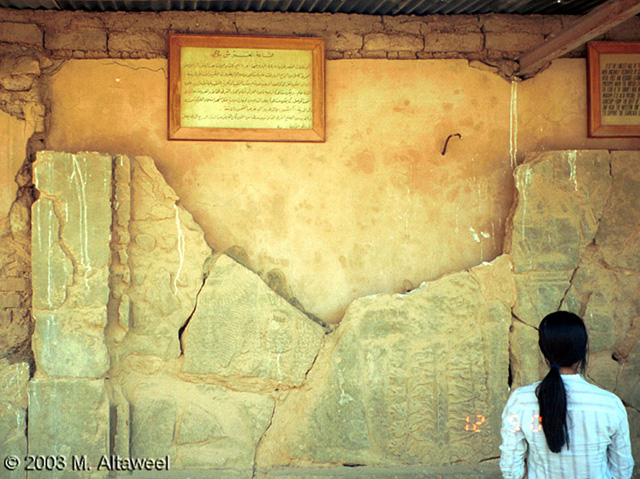
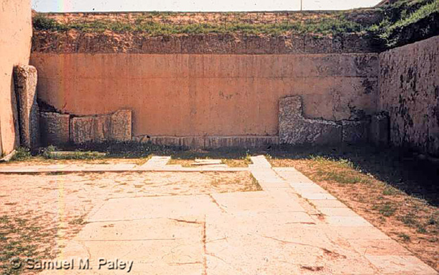
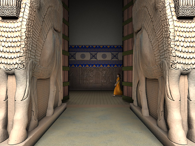
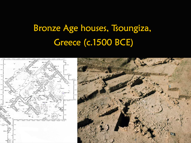
Even archaeologists have difficulty interpreting sites that look like a bunch of rocks, let alone trying to envision how ancient cultures lived and used these sites (see the example at the left; hover over to enlarge). Visiting archaeological sites often offers no better options for understanding multiple stratigraphic layers on top of each other, or generations of use, reuse, and remodeling of individual buildings. There had to be a better way to learn about the past.

Tsoungiza West House reconstructed 
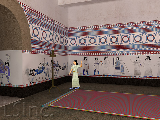
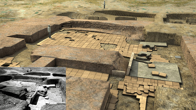
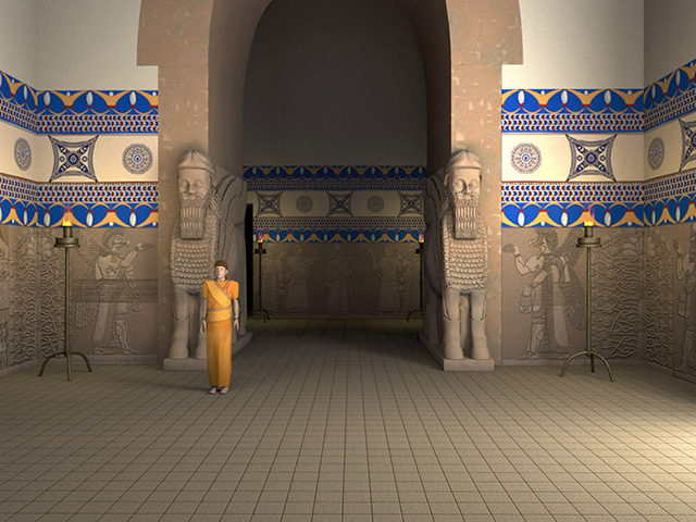
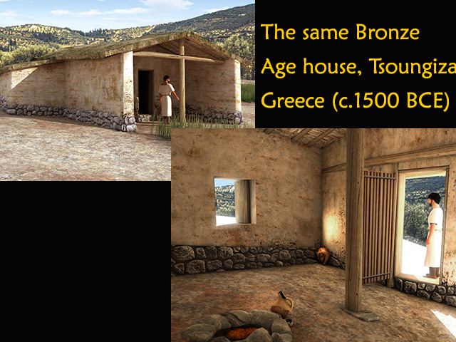
It took a while for computer software to catch up to my wishes, but things eventually came around, and now we can begin to appreciate ancient buildings and cities in ways that approximate the viewpoints of the original inhabitants (the house at the left is from our virtual reality model; hover over to enlarge).

projects montage
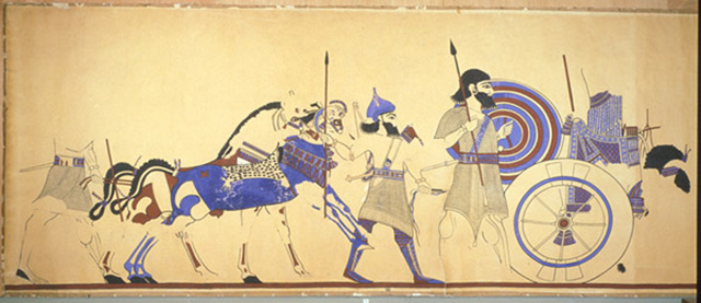
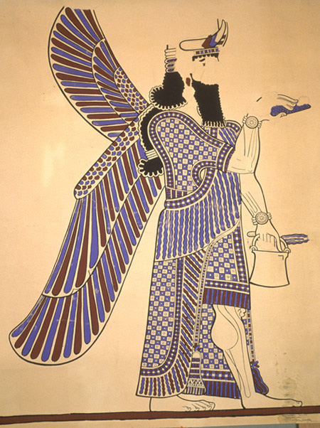
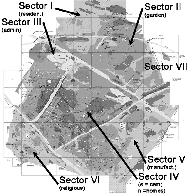
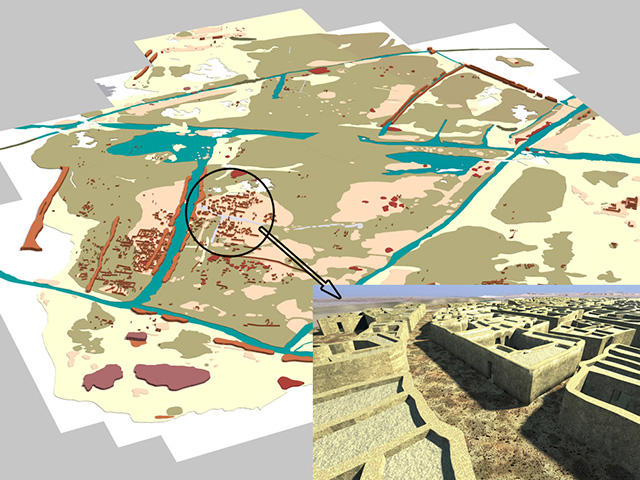
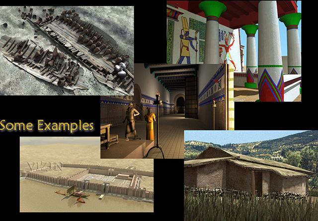
Our Institute for the Visualization of History is a unique 501(c)(3) nonprofit educational organization comprised of archaeologists, art and architecture historians, as well as programmers and computer graphic artists. We are an outgrowth of Learning Sites, a company I founded in 1996, the oldest company dedicated to virtual reality-based archaeological education and research. The Institute and Learning Sites are not graphics houses, but teams of professionals working to bring history to life again through vivid visualizations of the past re-created to the highest standards of scholarship (some examples of our projects at the left; hover over to enlarge). We digitally reconstruct historical locations, objects, events, and cultures for museum display, research, documentation, publication, teaching, broadcast, and tourism. We're based in Massachusetts, but work on projects all around the world, for museums, universities, publishing companies, antiquities services, and foreign governments.

My colleague and predecessor on this podium, Prof. Jeffrey Clark, has already briefed you on the nature of virtual heritage (or at least those of you diligent enough to attend all the lectures here). So with his expert review in mind, my focus this evening will extend the discussion to just how the use of interactive 3D digital models, in some of the projects we have worked on, respond to the pressing problems plaguing the cultural heritage of the ancient Near East.

today's topics
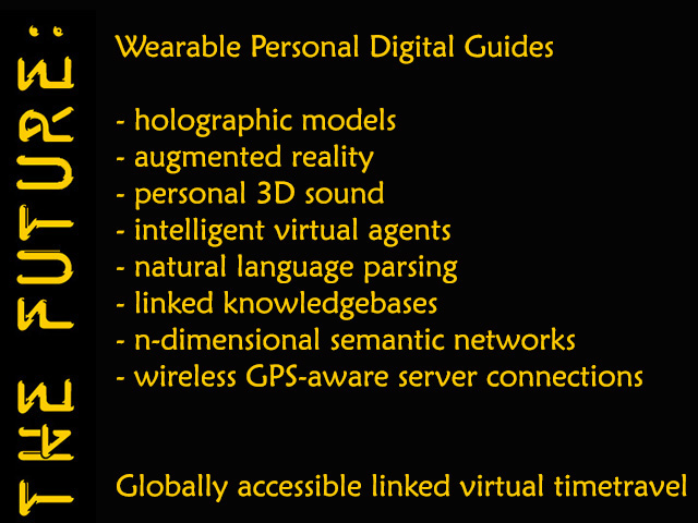
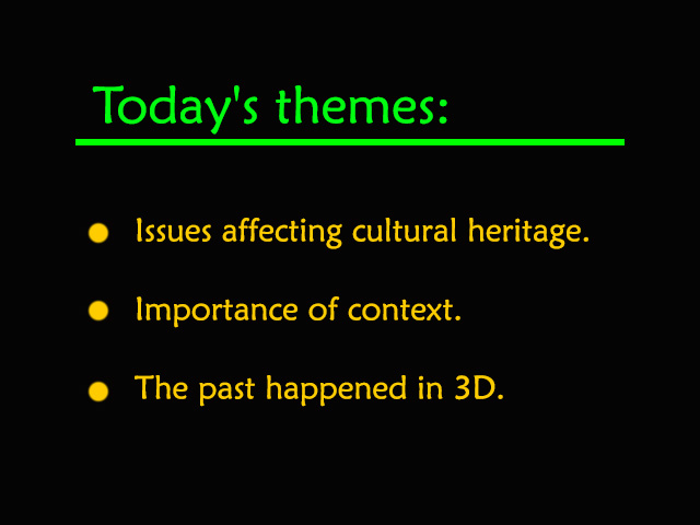
I'll touch on 3 major themes (hover the list at the left to enlarge):

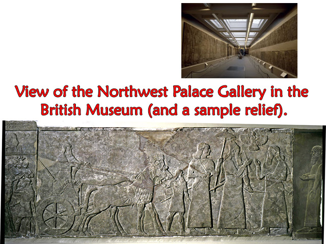
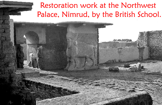
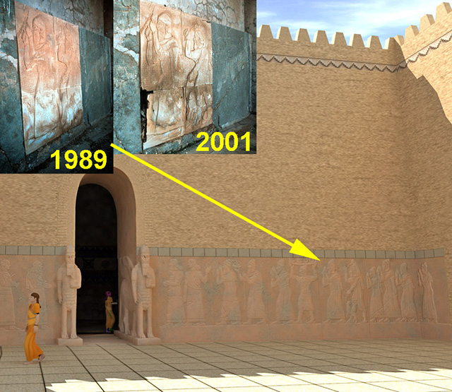
  • the issues affecting our shared global cultural heritage--such as, long-term preservation, on-going looting, documentation, and the worldwide dispersal of objects from sites around the region;
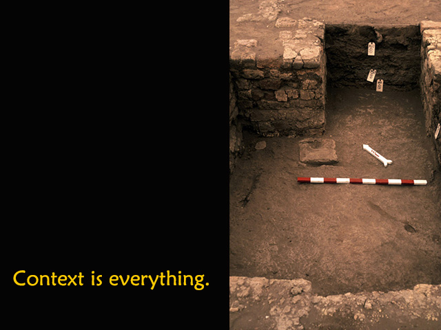
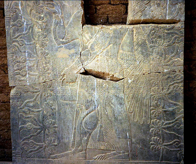
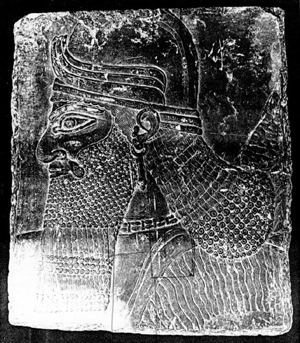
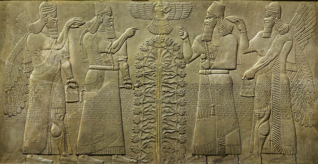
  • the importance of context in archaeology for interpreting object function and meaning; and
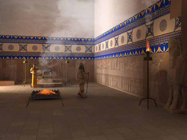
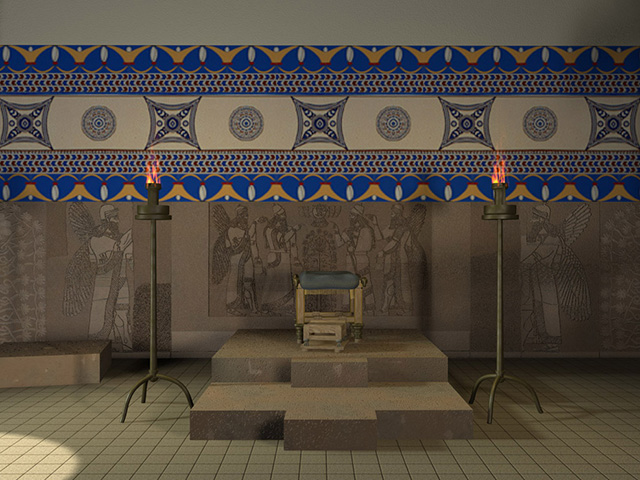
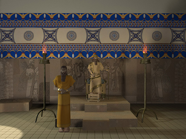
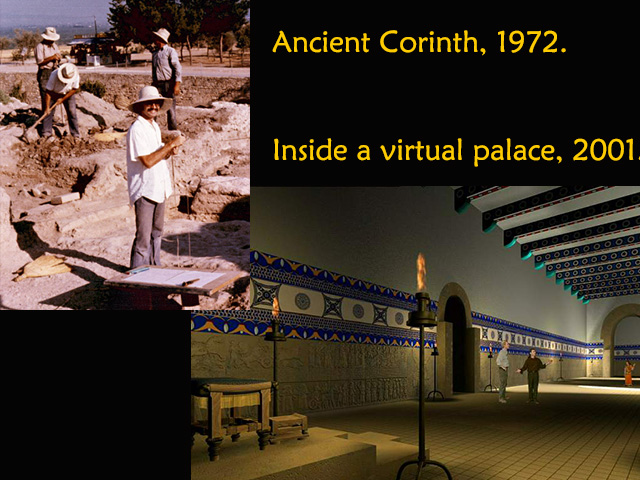
  • the point that since the past happened in 3D, so 3D should be the means we use to study it; using static images on paper or film to try to grasp the dynamic, changing, and interactive threads of history just doesn't cut it anymore.


 II. Review of Issues Affecting Cultural Heritage

decay at the Northwest Palace, NimrudFirst, what are the issues affecting our ability to study the ancient cultures of the Near East? The remains of past civilizations are constantly affected by sustained deterioration from the weather, natural disasters, wars, looting, and neglect (see the examples at the left; hover over to enlarge). No where is this more acute than in the countries of the Near East. For example, those countries had, before the recent conflicts, some of the best antiquities departments in the world, whose staff would carefully guard their archaeological sites and museums, and who would cooperate fully with teams from the West in excavations, research, and scholarly publications. Unfortunately, that has all changed, and as a result, 1000s of years of world heritage and some of the oldest settlements in the world and their ancient art masterpieces are disappearing forever.

The deterioration of sites in the region is hastened because of the prevalent use of mudbrick, which is the preferred construction material since good building stone is scarce. Mudbrick needs much attention if it is to survive for generations, let alone for centuries. The use of baked and fired brick helps, but these, too, are fragile materials. With such long-term degradation occurring, it becomes paramount to try to capture and preserve a complete record of what is there at the moment, preferably using 3D laser scanning or modeling technologies.

context is everythingIn archaeology, context is everything, just as it is for understanding any socio-cultural or historical occurrence. Without associating objects with their architectural, chronological, and artifactual contexts, it is virtually impossible to assess the total value of objects, determine how they were used, where they were used, when they were used, and how the ancients perceived them. Human history is comprised of linked events associated with sets of objects fixed in space and time. Without this information, reconstructions of the past are tenuous at best. Objects without verifiable context are meaningless to historians; the past cannot be deciphered, and chronological or cultural connections to our own heritage cannot be created, leaving us isolated and parentless.

The examples of our work that I'll discuss run the gamut of illustrating the problems and also demonstrating solutions. In some cases, our solutions show how new types of visualizations can help resolve some of the problems, while also leading researchers to gain new insight into the past--new insight that traditional 2D or paper-based imagery could not have discovered. I'll first briefly run through a few of our projects and how they relate the issues under consideration today, and then I'll go into much more depth about one of our largest endeavors, concerning a site in Iraq.

One key to caring for and protecting heritage materials is to provide students and future caretakers with a good education on the value of history, the importance of cultural context, the meaning of religious tolerance, and the appreciation for the interdependence of events across a large region. All that and more, for example, provide the rationale for our rich and deep Digging Jerusalem project, which will soon become part of massive online and free educational portal on Judaic studies.

Barsib site planNext, we'll visit the provincial Assyrian settlement at Til Barsib, in Syria (see the site plan at the left; image courtesy of Guy Bunnens; hover over to enlarge). The site is comprised of a palace, lower town, and fortification walls mostly dating to the 9th century BCE.

Barsib palace planBarsib Queen's reception roomThe main palace and one gateway were excavated by the French 1929-1931. Theirs was a standard and, for the time, complete publication of the site, which included a few plans and some sample photographs of the major finds--these would be the bases for any further research or interpretations (see the palace plan and view into the so-called Queen's Reception Room at the left, from the French publication; hover over to enlarge). The walls here are of mudbrick covered with thick plaster, often painted. Today, the Palace is gone completely with a new village, built over its foundations; while the settlement's lower town is mostly disappearing beneath an encroaching lake and a high watertable.

The Palace had the best preserved and most extensive set of Assyrian wall paintings that had survived from the ancient world. As they were being uncovered, the French team's artist made watercolor drawings of the bright hues, decorations, Assyrian figures, and animals. Realizing that one of the disadvantages of archaeology is that as soon as you uncover something it's immediately prone to weathering and decay, the French decided, when the drawings were completed, to remove the paintings from the wall surface and ship them to the museum in Aleppo, Syria. There the paintings were coated with shellac to protect them, and then put on display. The drawings went with the French documents back to the Louvre in Paris.

Barsib wall paintingBarsib wall paintingThe problem with old shellac is that it eventually turns opaque and bonds itself chemically to the surface beneath it. So, the unique originals can no longer be seen, and the shellac is now fused to the original Assyrian paint, making removal impossible. All that leaves for anyone to study are the watercolor copies, but they are in the Louvre archives (see two of the Cavro drawings at the left, images courtesy of the Musee du Louvre; hover over to enlarge).

reconstruction of the King's Reception roomWhen we began to model the palace, we contacted the Louvre and obtained permission to use new digital high-resolution images of the archived drawings so we apply them as textures in our computer models (see our reconstruction of the King's reception room at the left; hover over to enlarge). Our results became the first time anyone had seen the surviving fragments of the original wall decoration back on the walls in their original spatial and architectural contexts. Now the Assyrian spaces and their amazing decoration can be fully appreciated once again as never before in 3D and in stunning color (see, for example, the panorama below; left click and use your mouse to rotate and zoom). The Palace model became part of a large educational package commissioned by a private school in New York City.

Barsib QTVR as WebGL

map of Near Eastern sitesNext, we'll head down to southern Iraq and the 4000year-old Old Babylonian city of Mashkan-shapir, situated about 150km south of Baghdad (see the map at the left; hover over to enlarge).

Mashkan-shapir aerial viewwalking Mashkan-shapirThe site, covering 72 hectares or nearly 200 acres, was investigated 1987-1990 by an American team using kite photography (see the aerial views at the left, image courtesy of Elizabeth Stone; hover over to enlarge), walking around site (see a shot of the team walking the site at the left, image courtesy of Elizabeth Stone; hover over to enlarge), and doing a few small test trenches.

Mashkan-shapir site planMashkan-shapir is potentially a very important site, because its layout indicates that it, and probably other contemporaneous ancient Mesopotamian cities, were planned and organized around an extensive canal and harbor system that connected the city's districts to the Tigris River, and thus by water to the rest of the region (see the site plan at the left; hover over to enlarge).

Mashkan-shapir lootedUnfortunately for researchers and despite its historical significance, the site has, within the past couple of years, been thoroughly and systematically looted (see an aerial photo at the left showing looters' holes; hover over to enlarge). For all intents and purposes, it is gone. Like so many sites, its artifacts are slowing making their way without context onto the antiquities market for sale, or they are being stored until the heat dies down at which time they will still become lost into private collections. It';s been estimated by Iraqi and American archaeologists that there are 3000 excavated sites and 10,000 unexcavated sites in Iraq. There are currently 1600 guards for these sites; do the math; it's not pretty. Even with nominal coalition protection, we are permanently losing dozens of sites per month.

Mashkan-shapir site modelWe are slowly working our way through the satellite images and survey data of Mashkan-shapir in order to build 3D computer models of the site and then to interpolate based on evidence from related sites what Mashkan-shapir may have originally looked like and how its canal systems worked (see an example of our model at the left; hover over to enlarge).

map of Near Eastern sitesLet's now move on to one of the most well-known sites in Iraq, the ancient Assyrian capital at Nimrud, about 300km north of Baghdad (see the ma at the left; hover over to enlarge). A little over 150 years ago, a young British adventurer named Austen Henry Layard began excavations at two sites in northeastern Mesopotamia, in what is today Iraqi Kurdistan: at Kuyunjik, the citadel mound of the ancient city of Nineveh and on the citadel mound of Nimrud, the site of the ancient city of Kalhu.

Nimrud citadel aerialThere might be as many as seven palaces and palatial buildings, six temples and temple complexes, and six townhouses on the citadel of Nimrud alone. Most of them have been partially excavated (see the aerial view at the left; hover over to enlarge; ed. note: due to ISIS/Daesh dynamiting at the site in the 2010s, many of the palaces are now completely gone).

Nimrud citadel planThe Central Palace, near the middle of the citadel, was excavated in the mid-1970s by the Polish Centre for Mediterranean Archaeology (see the Nimrud citadel plan at the left; compare with aerial view above; hover over to enlarge). Their sessions ended abruptly with sudden death of their team's director. From then until recently, the material from their work lay dormant. We're now building a completely digital excavation report with help from American and Polish Assyriologists (1) because lately items from the storerooms of the excavations have been appearing on antiquities market; (2) because this is a key building to understanding the architectural history and spatial planning of the citadel at Nimrud, and (3) because it's the duty of archaeologists to make their data known to peers for their further analysis, and a digital publication report can deliver far more data more effectively than a traditional codex-based report.

Nimrud Central Palace area trenchNimrud citadel planSince no 3D laser scanners were available in the 1970s, all documentation is in the form of photographs, drawings, and fieldnotes (see a sample excavation photo at the left; hover over to enlarge). The entire Central Palace area is now covered over and parts are beginning to erode. In order to study the buildings there more closely, we turned to 3D modeling techniques to reproduce the results of the older excavations so that researchers could once again study objects in context and understand the function of the buildings more accurately (see our 3D model of the trench at the left; hover over to enlarge).

So, site and sculpture photographs became 3D models (as in the model of the lamassu above; use the left mouse button and the mouse to rotate and zoom) and fragmentary material could once again be studied as a whole. This project is continuing as we build an online database which will provide global access to all of the scanned photographs and drawings, our 3D models, and newly composed descriptions and analyses.


 III. Detailed Case Study on the Northwest Palace

Northwest Palace, Nimrud locationIn my final, and most extensive example, let's move on to look at the history of and our work on the most important royal building complex at Nimrud. It was at Nimrud that Layard unearthed the best preserved of the ancient palaces of Assyria, which we have come to call the Northwest Palace, belonging to King Ashur-nasir-pal II, an Assyrian monarch who ruled from 883-859 BCE. It's called the Northwest Palace simply because it was found near the northwest corner of Nimrud citadel mound (see the Nimrud citadel plan at the left; hover over to enlarge; ed. note: the Northwest Palace no longer exists due to dynatiming by ISIS/Daesh in 2016).

LayardLayard worked from 1845-1851 excavating and documenting the site (see a portrait of him at the left; hover over to enlarge).

Layard removing bull statuesLayard removing wall reliefsDuring these years, he and his assistants removed from the ruins of the Northwest Palace the collapsed brick decoration and stone bas-reliefs that ornamented the palace's walls. Several drawings preserved in the British Museum and in the British Library in London testify to the Layard years in Assyrian Mesopotamia. Here he is at Nimrud, supervising the removal of two human-headed, winged bull figures, called lamassu, from a gate in the central courtyard of Ashur-nasir-pal's palace. The bull on the left is in the Metropolitan Museum in New York City. There are also sketches of workmen lowering bas-relief from the palace's walls (see the drawings at the left; hover over to enlarge).

Over the course of Layard's excavations and those of his Nestorian Christian assistant, Hormuzd Rassam, with Ottoman approval, and the approval, support and assistance of Henry Rawlinson, the British government's representative in the area, the stone reliefs were distributed to friends, family, and the British Museum.

Rassam excavatingVisitors came to Nimrud both during and after the concluding years of Layard's time in Mesopotamia and then in the years during which other British excavators worked there. These visitors received permission, literally, to mine the site of what were considered duplicate images, some of them among the finest examples of 9th-century BCE bas-relief sculpture. The photograph at the left (hover over to enlarge) shows the citadel mound as it appeared during Rassam's second time at Nimrud, between 1878 and 1882. It is one of the earliest excavation photographs of Nimrud, and one of only a few surviving images of what the site must have looked like in the 19th century. You can see what are probably remains of pieces of the relief slabs on the right, set out of context.

When American missionaries visited the sites of Assyria, which for them were both a curiosity and of religious interest, because both Nineveh and Kalhu are cities mentioned in the Bible, they came away with whole or parts of relief slabs that were purchased, sometimes for only a few hundred dollars. They sent the sculptures home to their respective colleges and seminaries from Virginia to Maine. These transactions are documented in the records of the institutions that received the sculptures as gifts from these missionaries, often alumni of those American institutions.

Marsh lettersThe records show that the bas-reliefs, if they were not already broken, were cut up into smaller pieces so that camels or donkeys could more easily transport them over land to where they were loaded on ships bound for Europe and then America. This letter is from the records of Williams College in Williamstown, Massachusetts, the first American college to receive sculptures from Nimrud (hover over to enlarge). Layard, Rassam, and Rawlinson had also cut up the bas-reliefs for more easy transport away from the site.

Northwest Palace S-10 missing its headS-10 head itselfProof of this practice is everywhere evident at Nimrud in the [ed note: formerly] extant remains of the Northwest Palace. The slab pictured at the left, from a room in the palace's southern wing, must have proven too great a task for removal, even though its upper half was broken when found, or got broken while it was being considered as an example worth taking. In any case, the human head of the winged deity, a so-called genius, one of the protective divine figures that feature prominently in the iconography of the audience halls of the Northwest Palace, was chopped away from the rest of the bas-relief slab and found its way to the United States by itself. It's now in Chicago's Art Institute (see the image at the left; hover over to enlarge). In the old exhibit there, it was shown in a frame like a picture, as a discrete piece of art, treated as if unrelated to the rest of the original figure. Today it's shown without the frame and with an accompanying drawing to show at least its immediate context.

reliefs in the British MuseumTracing the buying and selling of these reliefs and fragments of reliefs over the last 150 years has become a daunting task. Examples of sculpture from the Northwest Palace have been identified in 65 museums and private collections across the world. The largest collection of bas-reliefs from this palace outside of Iraq is in the British Museum. Many of them are from Layard's original excavations and originate from the palace's throne room (see an example at the left; hover over to enlarge).

British restoration at NimrudIn the 1950s and 60s, Max Mallowan and David Oates returned to excavate Nimrud on behalf of the British School of Archaeology in Iraq. During this time, the British School re-excavated Layard's finds and extended their investigations into parts of the palace that lay untouched by the 19th-century work. They also began to restore fallen or removed bas-relief back onto the walls (see a view of their restoration at the left, image courtesy of Samuel Paley; hover over to enlarge). The principal result of the British excavation was the realization that the palace was much vaster than Layard's plans and reports indicated. When the British moved to work off the citadel to excavate in the lower town, the Iraqis continued to excavate, ultimately turning the palace into a site museum.

Polish team photo of in situ remainsIn 1974, the Polish Centre for Mediterranean Archaeology, based at the University of Warsaw, arrived at Nimrud with a contract to excavate the area of the Central Palace area, which I've just discussed. One of the by-products of the Polish time at Nimrud was that its director, Janusz Meuszynski, had the whole Northwest Palace documented on 35 and 120mm film, including the new restoration work--every fragment of fallen and broken bas-relief, and all the pavement slabs (see an example at the left, photo courtesy of Richard Sobolewski; hover over to enlarge). Meuszynski also arranged with the architect of the Polish excavation, Richard Sobolewski, to re-survey the site and record it in plan and in elevation.

NWPalace plans comparedHis data became the basis for the first scientific drawings since Layard's time. To illustrate how much more we know about the palace plan 150 years after Layard's time, this is Layard's plan compared to Sobolewski's (see the comparison at the left; hover over to enlarge). After the accidental death of Meuszynski in the spring of 1976, the Polish work at Nimrud ceased. Sobolewski became the caretaker of all of Meuszynski's records, finishing the publication of part of the Northwest Palace and then turning to Samuel Paley to help with the rest. In 1992, they completed a restoration on paper of all the known evidence about the Northwest Palace.

However, because there are several possible ways that sculpture was taken from Nimrud, with or without permission, we don't know how many reliefs remain to be discovered in private collections. Every few years, another fragment surfaces on the antiquities market. Today we can document the whereabouts of 321 complete and fragmentary sculptures from the Northwest Palace out of context. Because of the sculpture's global distribution, neither scholars nor the general public can fully comprehend the palace or its sculptural and architectural splendor as King Ashur-nasir-pal intended, as the ancient Assyrians once used the complex, nor even how it looked when first discovered. And more pieces continue to be taken from the Palace today, though now it is without anyone's permission or documentation, so these sculptures then disappear.

All of the issues that I wanted to focus on today (cultural heritage deterioration, loss of object context, and the benefits of 3D modeling) come together in this one building. Reliefs have been globally dispersed, looters continue to ravage the exposed remains, and nature is eating away at the sculpture and walls. Further, gun battles take place inside the ancient rooms. All these factors make the Palace and its history an ideal candidate for the application of virtual reality technology; this fact was recognized by Samuel Paley when he approached us a few years ago with the prospects of rethinking all of our knowledge and assumptions about the Palace.

Northwest Palace B-8 errors in drawingWe first began the modeling process by relying on the only set of published drawings of the reliefs, until we discovered that they were not as accurate as everyone had though (compare the drawing and photograph of relief B-8 at the left; hover over to enlarge). So, we had to deal with the global dispersal issue, by beginning to contact, one by one, each of the institutions and private individuals holding reliefs from the Palace and negotiating with them for new digital photographs of the sculpture. We use those images as the basis for our models' textures ensuring that they will be as precise and detailed as possible. This is a slow process, and one that we've not yet completed; there are nearly 100 rooms in the Palace, covered with as many as 35 reliefs each, plus wall paintings.

Northwest Palace throne room reconstruction renderingTo fill in gaps in the surviving evidence, we have colleagues who are combing the logbooks, field notes, and diaries of the many people who have excavated here over the past 150 years--nevertheless, things are progressing (see our rendering of the throne room at the left; hover over to enlarge).

Northwest Palace relief B-13 damagedHere's an example of the destruction that looting can do (see the photo of relief B-13 at the left, image courtesy of the Polish Centre of Mediterranean Archaeology; hover over to enlarge). This is one of the most well-known reliefs in Assyrian iconography. It's still situated on site in the Throne Room [ed. note: as of 2007 it was in situ; it no longer exists], positioned just opposite the main central entrance into the Throne Room from the Great Northern Courtyard. Layard didn't take this panel to England, because it wasn't in as good condition as its duplicate (originally located behind the throne).

Northwest Palace relief B-13 drawn with contextThis scene's special place in the Throne Room's decorative program is emphasized by the two panels that immediately flank it to the left and the right, which seem to show the king looking at this scene (see the drawing at the left; hover over to enlarge). The meaning of this group of figures is obscure, but might represent the king observing himself (or an ancestor) performing a ritual act. The ritual has been interpreted as caring for the king and the agriculture of the land, and thus metaphorically, the Assyrian state itself. In the central scene, the royal figure raises his hand in a gesture of prayer before a sacred tree and the god in the winged disk above; the genius holds a date palm spathe and bucket normally associated with the ritual. The duplication of the figures facing in opposite directions is a common feature of Assyrian art and has been interpreted as an aesthetic need for a balanced composition, thought some have suggested that the figures are circling the tree.

relief B-13 partially lootedSometime in 2003, looters entered the Throne Room and stole the piece depicting the god in the winged disk and the top of the sacred tree, thus removing the focal point and central meaning of the scene (see the image at the left taken soon after the looting, image courtesy of Marl Altaweel; hover over to enlarge). The fragment has not yet been recovered, but as it's so famous, it's difficult to see how the looters will be able to bring it to market.

location of relief B-23The duplicate to this relief used to sit here, behind the throne (see the view at the left, image courtesy of Samuel Paley; hover over to enlarge). Since this panel was in nearly perfect condition, Layard shipped it off to the British Museum, along with much of the rest of the narrative decoration from the Throne Room.

laser scan of relief B-23Here's an image of relief B23 in the British Museum taken with a 3D laser scanner able to capture even the smallest details in the stone and the carving techniques (see the image at the left, image courtesy of Adam Lowe and Factum Arte; hover over to enlarge). It's a beautiful piece, but divorced from its original context, it can only be appreciated as an isolated work of art, not as a useful piece of history that informs us about Assyrian ritual, about the sculptural program of the Throne Room as a complete story, or about how carefully planned that story was for ancient visitors to the Palace...

our rendering of throne roomas seen here in a rendering from our computer model (hover over the image at the left to enlarge).

our rendering of B23 in context; no kingour rendering of B23 in context, with the kingHere are a detail view of the relief and its neighbors and also how the king would have obscured and substituted for the central tree when the scene would have been seen from the view of visitors to the Palace (hover over the images at the left to enlarge). The focus of the scene on the back wall now becomes the king, rather than the tree, an iconographical nuance heretofore unrecognized before our models demonstrated this relationship--the tree substitutes for the king in his absence or in special alignments,

our rendering of the throne room central doorwayas with the view through the central doorway (which was ceremonial only and not meant to be used by visitors; hover over the image at left to enlarge).

coalition troops guarding the palaceLet's turn briefly to looting. Looters don't go quietly. As result of current turmoil in Iraq, gangs of looters often overrun the Palace looking for material they can quickly remove and shunt off to the black market and make some quick money. They usually hide and wait for coalition troops to leave, before descending. The one or two site guards with pistols are no match for the groups of 20-50 looters carrying machine guns (see the image of coalition troops at the palace at the left; hover over to enlarge).

bullet hole in a reliefbullet hole in an inscriptionbullet hole in storeroom door

Throughout the Palace, now we can see evidence of the guards brave attempts to stand up to the gangs--there are bullet holes in the reliefs, inscriptions, and doorways to storage areas (see the images above courtesy of Mark Altaweel in 2003; hover over each to enlarge). Needless to say the damage is irreparable. These photos were taken a few of years ago, when photographers felt relatively safe accompanying the troops; since then, as the situation has worsened, we no longer have eyes at the site.

decay of wall reliefsWe're also dealing with serious deterioration at this site, as now the country has no funds nor the antiquities service infrastructure to maintain all its treasures. We can, at the very least, use our 3D graphics technologies to create digital surrogates that record the current status of the monument to be used as the basis to track the rate of decay and weathering (see the condition of one of the courtyard reliefs at the left with our rendering; hover over to enlarge). Here's an example of stress fracturing caused by changes in temperature which in turn cause the fragile and soft limestone sculpture to crumble and break.

   Using interactive 3D graphics we can replicate the look and feel of the Palace, get a near firsthand experience of the whole from the ancient Assyrians point of view, and study various lighting conditions, sight lines, the sculptural program in entirety, and complex spatial relationships in ways impossible with other traditional media (such as with our recent video for the Hood Museum of Art at the left). In just a short time, we have come to understand this building much more completely than ever before. Our Web pages about this palace get around 60,000hits/month mostly from scholars and schools around the world.

So far, I have shown you only static renderings of how our work has progressed in interpreting the evidence from the Northwest Palace. However, since the many problems affecting this Palace has made it an ideal project for VR, we should spend some time investigating the virtual environment. As we collect material upon which to base our 3D model, and as our model expands, we try to keep all the evidence together in one place for research, education, hypothesis testing, and just plain for the fun of wandering around inside a once lost treasure (ed. note: at this point in the presentation a VRML-based VR world of the palace was demonstrated, but that format is no longer supported by browsers; we are in the process of upgrading the palace virtual world into a WebGL world).


 IV. Conclusion

To summarize> what we've covered this evening: there are many issues affecting our knowledge about the past, as manifest in the problems facing the cultural heritage of the ancient Near East--the natural and human-induced destruction of sites and artifacts; the importance of context; and need to match study of the past with tools that simulate the past, or else we're not getting the full story. I've also tried to demonstrate how interactive 3D computer graphics and their resulting visualizations can help historians learn about the past from the point of view of the original inhabitants, and at the same time provide engaging educational materials, innovative research environments for testing theories about the ancient cultures, architecture, and lifestyles, and provide unexpected new insight into the events and threads that comprise our shared heritage.

the futureWith this background, you might well ask: where will this approach lead us in the future? Speculating about what might happen down the road is always fun, even if a bit frivolous. Given the rapid pace of change in computer technologies now, what may seem outrageously far-fetched today will likely become old hat in less time than it would take me to explain it. But, that never stopped me before, so, here are some of the things that are on the horizon or already in development in the realm of virtual heritage (see the image at the left; hover over to enlarge). Extrapolating from current trends, it is not difficult to imagine that soon we will have location-aware wearable computers linked to a 3D-based semantic Internet with the capability of projection holographic imagery; this is the personal virtual timemachine. Use it wisely.

A couple of years ago, historian David Staley [Executive Director of the American Association for History and Computing] wrote that computer visualization when used "to represent simultaneity, multidimensionality, pattern and nonlinearity with … speed and efficiency" can do what "prose cannot capture." In his book Computers, Visualization, and History, Staley argues that the real impact of the computer has been as a graphics tool more than as a processor of words. The importance of 3D imagery lies in its ability to address longstanding concerns of historians who agree with the 19th-century writer, philosopher, and social reformer, Thomas Carlyle's observation that "Narrative is linear, Action is solid." Thus, the technical potential of computer graphics is that it can present a deeper and more richly rewarding history by giving a 3D solidity to past places and events, and at the same time act as a repository for the images, words, and objects that together define who we are and how we got here. In conclusion, remember that our study and understanding of the past need not be constrained by the methods or technologies of the past; and our questions about history and thus about ourselves can only benefit from new means of visualizing the answers.

Close this presentation and return to the Index