The Benefit of 3D Computer Graphics for the Historical Sciences

Paper presented on May 30, 2006, by Donald H. Sanders, PhD, at The Computer: The Once and Future Medium for the Social Sciences and Humanities symposium, Toronto, Canada.

posted here November 7, 2019


 I. Introduction

West House, Tsoungiza, Greece, interior reconstruction
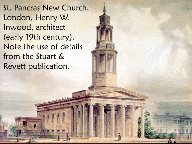
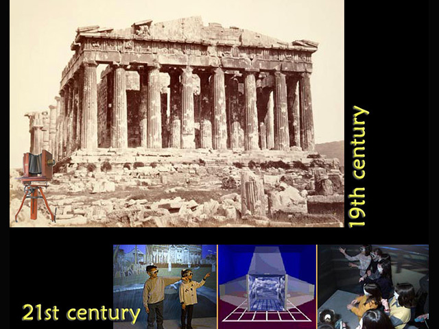
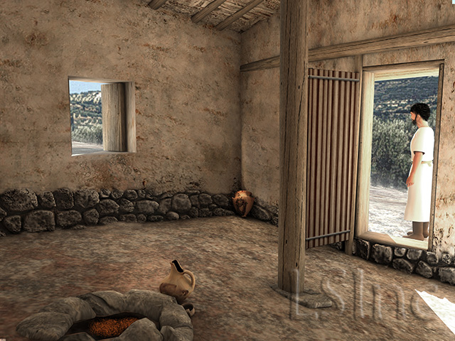
We in the discipline known as Virtual Heritage pursue our re-creation goals, because we see many benefits in visualizing the past interactively and in 3D, for research, teaching, publication, display, and broadcast. But we still need to convince the broader historical community, including the archaeologists who should be embracing our technologies, that it's to their advantage to see the ancient world as the ancients did, rather than as segmented, static 2D representations in black and white (our rendering at the left reconstructs the interior of the West House, Tsoungiza, ancient Nemea, Greece, Bronze Age, c.2700 BCE; hover over to enlarge).

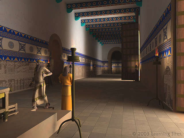
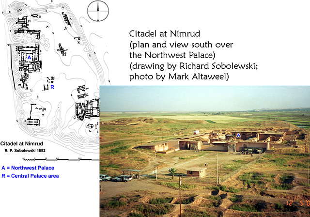
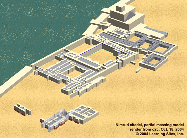
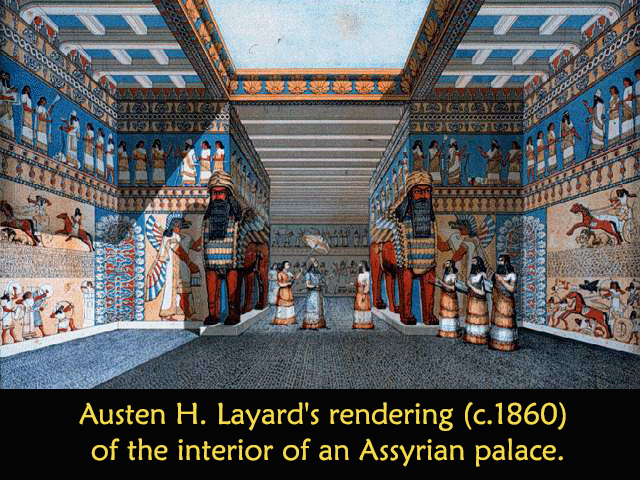
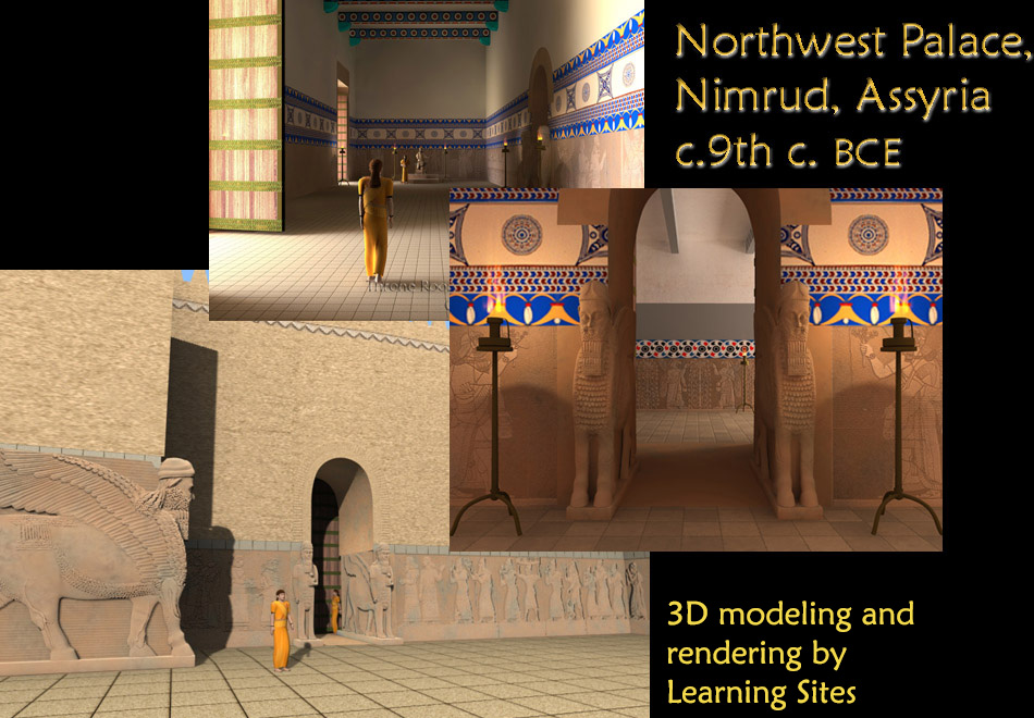
   In the 21st century, where video-enabled iPods, GPS-enabled camera cell phones, wireless high-speed home networks, and laptops for almost every schoolchild are commonplace, those who normally use imagery to supplement their descriptions should accept that interactive 3D environments are instructive, not eye candy. Or, more stridently: we could argue that archaeologists do a disservice to their discipline and to their colleagues by not using all means available to test their hypotheses about the past (the animation snippet at the left shows King Ashur-nasir-pal II [mid 9th c. BCE] ascending to his throne, Northwest Palace, Nimrud, Assyria).

today's topics
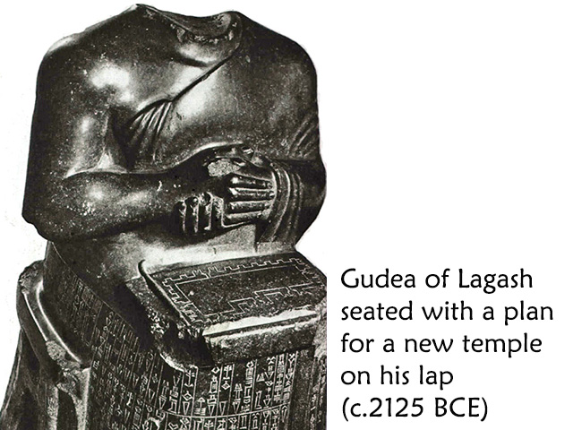
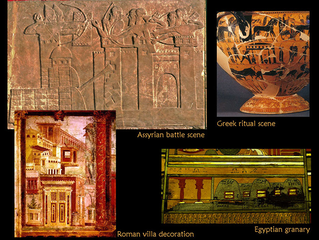
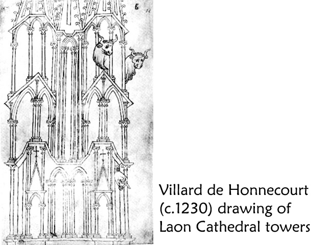
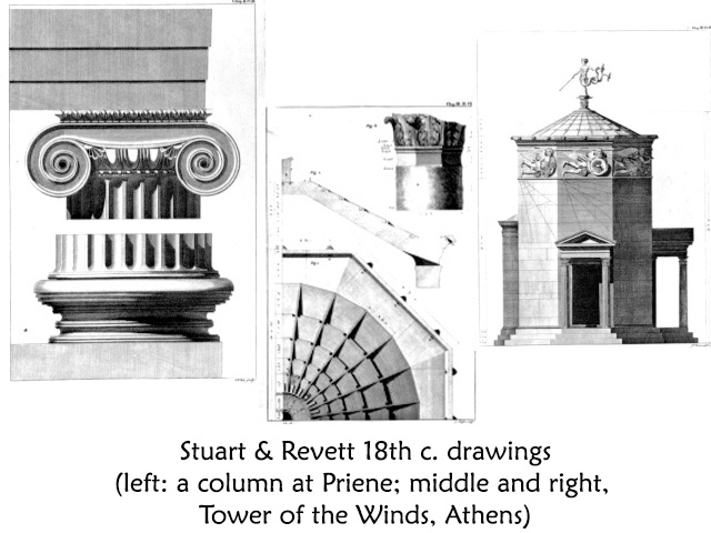
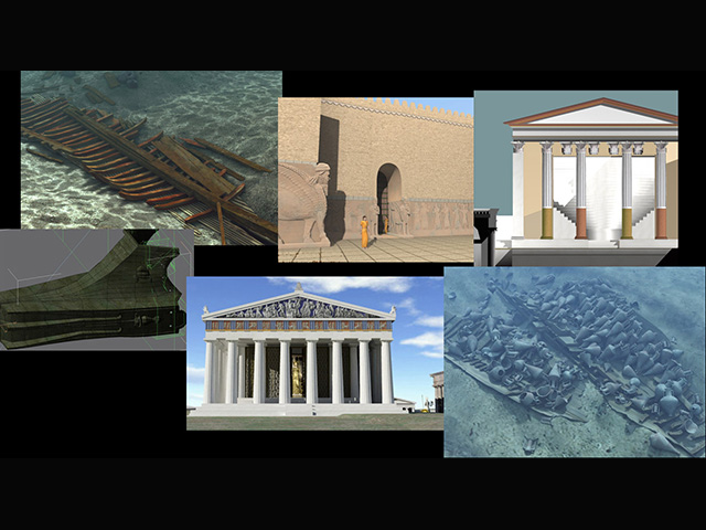
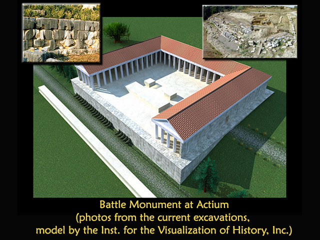
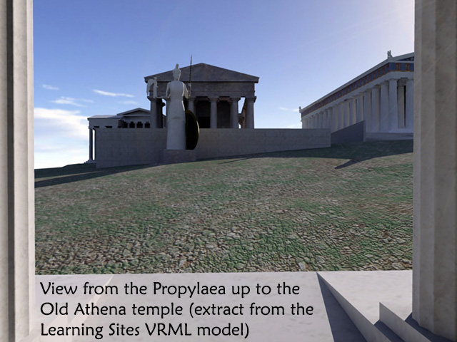
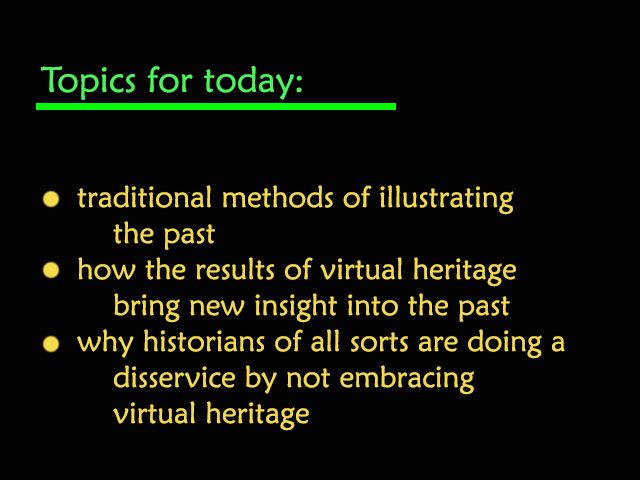
I'll talk about how buildings and sites have traditionally been illustrated and then review some of the ways in which interactive 3D environments in our projects have provided new insights impossible with traditional analytical tools.


 II. Overall view

Gudea with temple planArchaeologists rely mostly on drawings, photographs, charts, and graphs. But way back in time, there was stone. When Gudea (prince of Lagash in ancient Sumeria, around 2125 BCE) wanted a new temple built, he depicted his vision with a simple plan (see his statue at the left; hover over to enlarge). A plan was chosen because it symbolized the beginning of the construction process and could be reproduced fairly precisely on the ground. But Gudea was depicting future architecture not past architecture.

ancient depictions of architectureSimilarly, when the Egyptians, Assyrians, Greeks, and Romans depicted architecture (as room decoration, to record battles, or show foreign lands; see the examples at the left; hover over to enlarge) they were usually illustrating their present--for storytelling, education, or enjoyment--not trying to understand a distant past. Yet, the methods chosen to represent the built environment were relatively consistent--2D plans and elevations.

Villard de Honnecourt drawing of Laon CathedralPlans and elevations continued as the preferred means of representation to document the history of architecture at least since the 13th-century work of Villard de Honnecourt (see one of his drawings at the left; hover over to enlarge). Archaeologists traditionally record architecture using precisely the same methods. This occurred because the development of archaeology as a discipline in the late 18th and early 19th centuries coincided with the rise of Classical revival styles in architecture.

Stuart & Revett drawingsSt. Pancras New Church, London with same detailsArchitects needed accurate renditions of ancient Greek and Roman building details in order to design in the popular styles, and they needed those delineations in the same formats they used to submit their designs to builders (see the comparison at the left of field drawings and use of the same details in contemporary architecture; hover over images to enlarge).

19th vs. 21st c. techIn the 1840s, a radically new technology emerged. Photography offerred archaeologists a more efficient and effective means of recording their work and providing duplicate images for mass distribution (much as 3D models can today). Travelers immediately used the new process to document newly discovered ancient architecture. But archaeologists resisted accepting it into normal fieldwork and reporting, for many of the same reasons that interactive 3D graphics have been slow to become widely adopted (hover over the image at left to enlarge): the equipment is awkward, expensive, and breaks down frequently; the results can't be trusted; and too few people know how to use the technique adequately. Only toward the end of the 19th century did photography finally become the standard tool for recording excavations and artifacts. Nevertheless, photography remained little more than a way of illustrating monuments, enlivening reports, and providing visual aids for fundraising efforts until the mid-20th century. Only then, were photographs used to reveal every detail of excavations as they proceeded, marking their transition from mere snapshots to scientific recording.

Today, archaeologists continue to illustrate their publications and teaching materials with photographs, diagrams, and the same 2D plans, sections, and elevations that have depicted architecture for millennia, despite the benefits of computer graphics. When computer graphics visuals are included, they are usually added mainly for their eye-catching appeal, as was the case for early photographs.

Northwest Palace, Nimrud, renderingWhat kinds of computer graphics technologies are used for historical visualizations? Still 2D renderings (such as the Learning Sites digital reconstruction of the throne room in the Northwest Palace, Nimrud, Assyria, c.9th c. BCE; hover over to enlarge); and


  • Computer animations, like movies, with no user interaction (as in the snippet above); and

  • QTVR photobubbles, developed by Apple to mimic 3D space, because Apple computers could not process true x,y,z coordinate worlds (see the example below, from the Learning Sites 3D model of the palace at Til Barsib; ed. note 11/2019: the original QTVR file format is no longer supported by Web browsers, instead, we have converted the scene into a similar bubble-like environment using WebGL / HTML5; left click and use your mouse to turn and zoom); and

  • True virtual reality, which is a simulated 3D environment allowing users freedom to move and navigate objects. (ed. note 11/2019: in the original presentation, the virtual world of the double house from al-Meragh, Sudan, was a VRML world, but that format is no longer supported by browsers, so Learning Sites recoded the world for the current standard, WebGL; that world can be enjoyed below; use your mouse to navigate the world, 'c' freezes (and unfreezes) the world so that your cursor can click on green-highlighted hotspots; click on the 'i' in the upper right corner to access additional interactive content).

renderings montageBut, why do virtual heritage? I'll review some of our projects (see the sampling at the left; hover over to enlarge), with focus on only two aspects of virtual heritage: how our interactive 3D modeling projects have allowed for hypothesis-testing and also provided unexpected insights that would never have emerged from traditional visualization methods. Due to time constraints, I can only show you a few, presented here in no particular order.


 III. Examples

Actium renderThe Monument at Actium was built by Octavian (later Augustus) after his victory in 31 BCE over Mark Antony and Cleopatra, in the crucial naval battle for control of the entire ancient Roman world. The monument has a stone podium, into one side of which masons cut specially shaped sockets to hold the bronze ramming prows cut off from Antony and Cleopatra's sunken ships (see the rendering at the left; hover over to enlarge).

Roman ramming prow drawingWe recognized that the cuttings in the podium wall represent the negative shape of the backs of the rams.

Socket 4, ActiumEach socket is unique in its size and shape, reflecting the dimensions of the actual rams at the point of contact with the wall (see an example at the left; hover over to enlarge).

We first modeled the only surviving ancient bronze ram, found off the coast of Athlit, Israel (see the interactive model below; use the left mouse button and mouse to rotate and zoom).

Socket 4 rams modeled in placeNext, we modeled the site and its sockets. We could then take the computer model of the Athlit ram and warp it while keeping the proportions intact until it fit into one of the sockets (see the rendered results at the left showing the Socket 4 ram in its socket compared to the model of the Athlit ram; hover over to enlarge).

Relief from the arch at Orange, FranceWe used depictions of the battle carved on the monument at Orange, France, to refine the shape of the ram (see the image at the left; hover over to enlarge).

While building our first ram and its socket, other interesting results presented themselves. We could see first-hand the specific problems that were faced and solved by the builders of the monument in fitting the rams to the sockets; we were able to consider the problems faced by the artisans who designed the rams and by the founders who cast them; and, finally, we were able to calculate, from the 3D models that emerged, the weight of the original rams. Our process allowed historians, for the first time, to examine the accuracy of claims made by various ancient writers regarding the size and composition of the warring fleets, since here we will have a representative sample of the weapons, and thus the size of the ships, actually used in battle.

So, why then do Virtual Heritage? To gain new insight into one of the most famous ancient battles; to allow archaeologists to study the ship-building expertise and naval tactics of the ancient Romans; and to test the veracity of ancient Roman texts describing the battle. In other words, to ask questions and test theories about the archaeological data that could not be attempted otherwise. Here, we have been able to work backward from a single artifact to build a large historical picture and educate archaeologists about the nature of naval warfare.

Nimrud citadel plan and viewNext, the Northwest Palace of King Ashur-nasir-pal II at Nimrud, built in the 9th century BCE--the prototypical ancient Assyrian palace, the best preserved, and most elaborately decorated (see a plan of the palace location and a view of the remains at the left; hover over to enlarge; ed. note 11/2019: the palace was totally destroyed by ISIS/Daesh in 2016 and nothing remains but our computer models). Over the course of the site's 165 years of excavation, the palace's magnificent wall reliefs have become dispersed among more than 80 collections around the world, making scholarly research of the original complex as a whole impossible.

Nimrud citadel massing modelWe began with a massing model of the citadel topography and major monuments, and then to a detailed re-creation of the Northwest Palace based on extrapolations of existing remains (see a rendering from the massing model at the left; hover over to enlarge).

Layard's renderingThis was done to test the accuracy of previous visualizations, especially hand drawings and renderings that have been the basis for understanding the site since the mid-19th century (see an example at the left; hover over to enlarge).

comparing drawings to photographsWhen creating texture maps for our model, we discovered that the published drawings weren't very accurate, not in detail, the shape of figures, nor in transcription of the inscriptions, which have been relied upon for decades as the basis for cultural extrapolations (see the example at the left; hover over to enlarge). This offers a cautionary tale for those relying on period source material--go back to the originals.

Further, our consulting archaeologist announced: "I had all this data and was asked to hand it over to the computer graphics experts. I then realized more than before that what I had was not complete enough or precise enough for this new technology. Plans were inexact: some of them had been copied over by hand so many times that individual buildings had literally moved across the site. And the paucity of elevation data proved insufficient for the new digital tasks."

our reconstruction renderingsBut our results were convincing; he adds: "I am particularly pleased with such virtual reconstructions, because I am able to visit the site and travel through it and see things that I could not see in a single image before or even see easily and quickly if I were able to visit the actual ruined site; I could appreciate spatial relationships the way the ancient Assyrians intended." We quickly gained new insight into Assyrian use of lighting, the carefully planned locational relationship between the wall reliefs and interior circulation and sightlines, and thus about the iconographic, educational, and propagandistic purposes of reliefs and the functions of spaces.

So, why then do Virtual Heritage? To bring together for the first time, globally dispersed collections of material so that the original decorative schemes and narrative programs can be fully appreciated in a simulation of their original scale, lighting, color, and 3D spatial complexity. In the process, archaeologists came to realize how much data are missing despite 165 years of research; and how wrong the long-accepted illustrations of the building have been. Testing your data in three dimensions is crucial to verifying its validity.

Acropolis, aerial viewOur work on the Acropolis focused on the Archaic temple of Athena Polias (see the aerial view of the Acropolis at the left; hover over to enlarge). Our partnering archaeologist said that: "the challenge was to bring about a shift in perspective that would allow us to escape the tremendous authority and aura of magnificence with which the monument confronts the modern viewer and to consider it instead in terms of a solution to a set of problems in particular situations, and reconstructing a rational relationship between them."

Acropolis, aerial views compared"Our attention was focused on the major problem facing both statesmen and planners of the 5th century: What to do about the ruins of the Old Athena Temple that the Persian sack had left behind (see the older drawing and our model at the left; hover over to enlarge). The old hypothesis, that they merely cleared away unsightly rubble to make way for the new buildings seemed odd to us. We questioned whether the ruins had simply been dismantled and its footprint left vacant everafter."

Our source material included: nearly two centuries of excavations and measurements; ancient inscriptions describing the function of the site and the Classical building projects; ancient writers describing the buildings at various periods; 16th-19th centuries travelers' paintings, engravings, and sketches of the Acropolis as they passed by; and, the late-19th century discovery of the foundations of the Old Athena Temple.

view through the PropylaeaWe learned that none of the dozens of sets of published dimensions or elevations for the Erechtheum, Parthenon, and the Propylaea matched, leaving the buildings floating in relation to each other. Thus, it was challenging to set them in 3D space accurately with relation to each other and to the foundations of the Old Athena Temple. But with the help of old photos we were able to definitively fix that relationship and to argue that the Old Athena Temple stood in ruins as a war memorial. In fact, we demonstrated not only how the Classical buildings were built specifically to take the Old Athena Temple's ruins into account, and that the sacred ground was not left empty, but that it remained the focus of the Acropolis (see the view from our model at the left; hover over to enlarge), and survived albeit incognito amidst the dense warren of Turkish houses that were summarily swept away in the 1830s without consideration that the holiest Athenian building might still exist.

So, why then do Virtual Heritage? Because it forces re-evaluation of orthodoxy and a needed correction in the interpretation of basic bits of evidence. To quote our collaborator: "we were not to produce an illustration. The model's value resides in the same reasons why modeling is standard practice in schools of architecture--it provides the means of checking information and, most of all, of visualizing what one has in mind."

Great Temple, Petra, aerial viewThe 3000-year-old Nabatean city of Petra sits in a great rift valley in Jordan about 80km south of the Dead Sea. The major architectural feature of the city is the Great Temple precinct, comprised of a gateway, a lower courtyard (with colonnades and stairways on each side, which lead to the upper sanctuary), and the Temple itself. Inside this structure, a small theater and a stage area were installed during one of the last phases of use (see the aerial view at the left; hover over to enlarge).

   The goals for this project were a bit unusual, in that they focused on visualizing human activity to test archeological theories of site function, such as, how many people could have been seated in the theater, and how efficiently would they have entered and exited it, to and from the main city street (see the video).

Our test relied on simple virtual re-constructions of the built and natural environments, as well as ancient texts that were combed for examples of behavior in theatrical settings. Our team developed simulation software with parameters for sets of autonomous individuals, each with integrative motor, perceptual, behavioral, and cognitive components. The programming environment keeps track of the size of the audience, where each member of the audience sits, and how they interact.

Our experiments revealed that the theater could hold about 200 people comfortably; the audience needs about 7–8 minutes to enter and fill the seats, and approximately 5 minutes to completely empty the space. We confirmed that since the two vaulted stairways leading from underneath the theater to its seating are the only avenues for entry and egress, these areas become bottlenecks.

So, then why do Virtual Heritage? Now, yet another feature can be added to the world of virtual ancient environments, that of the inhabitants themselves. With such AI-driven simulations, we are able to fine tune behaviors and situations in ways never before possible for archaeological contexts.

Stearns Park viewMy examples so far have been from ancient sites. Since I don't want to slight the historians in the audience, I have one contemporary example. We were called upon to reconstruct the experience of visiting a lost inner city park (see a photograph of the park at the left; hover over to enlarge). The design for Stearns park, Springfield, MA, was a joint effort between Stanford White and Augustus St. Gaudens in the 1880s. White provided the overall layout and St. Gaudens the sculptural features that were part of their attempt to create a quiet place away from the noisy and dirty distractions of the city. Our goal was to re-create what it would have been like to enter the park and follow the paths according to the architect's original intentions.

Stearns Park design drawingPuritan statue, PhiladelphiaWe had few primary historical documents, including period photos (as above), one early sketch by White (seen at the left; hover over to enlarge), and a surviving statue by St. Gaudens similar to the one that stood in the park (see the Puritan statue in Philadelphia at the left; hover over to enlarge) but, these in themselves couldn't truly convey what it would have been like to experience the original space.

    As this was a quick project, the results do not have all the refinements that normally go into our visualizations, but they were enough to provide an art historian the opportunity to test her theories about the use of sound, viewpoints, and sequential experiences.

So, why then do virtual heritage? Our results provided corroborative evidence for the success that late-19th century collaborations had in countering the rapid pace of urban growth to give the public brief respites for contemplation; verifying theories about the results of such approaches, that cannot be tested in real life today, since the actual location and its features no longer exist.


 IV. Conclusion

In summary, we know that Virtual Heritage engages people to understand and become excited about all our broken stones and dusty artifacts. But what's really important is that we need Virtual Heritage in order to do our best work. Archaeologists must make use of the potential for their research, teaching, and publications or risk being irresponsible, in not bringing all the means available to the task of collecting, analyzing, interpreting, and disseminating the data about their excavations. Soon, those not using interactive 3D computer graphics will be seen as one now views those who have not published their excavation material--they are depriving the profession of vital information necessary for understanding the past, and may in some cases be culpable of leaving the discipline with misleading and incomplete information.

So, why do Virtual Heritage? Because there is:

  • no better way to test whether collected archaeological data works in reality;
  • no better way to test complex spatial, behavioral, and temporal hypotheses;
  • no better way to test the accuracy of past interpretations and evidence;
  • no better way to assemble globally dispersed artifacts back into a simulation of their original contexts;
  • no better way to visualize intrasite change and development; and
  • no better way to absorb complex datasets about the past than visually, interactively, and in 3D, just as we do in real life. Words are good; words and diagrams are better; linked databases and interactive 3D worlds are better yet.

A couple of years ago, David Staley wrote that computer visualization when used "to represent simultaneity, multidimensionality, pattern and nonlinearity with … speed and efficiency" can do what "prose cannot capture." In his book Computers, Visualization, and History, Staley argues that the real impact of the computer has been as a graphics tool more than as a processor of words. The importance of 3D imagery lies in its ability to address longstanding concerns of historians who agree with the 19th-century writer, philosopher, and social reformer, Thomas Carlyle's observation that "Narrative is linear, Action is solid." Thus, the technical potential of computer graphics is that it can present a deeper and more richly rewarding history by giving a 3D solidity to past places and events, and at the same time act as a repository for the images, words, and objects that together define who we are and how we got here. That's why we do virtual heritage.

Close this presentation and return to the Index