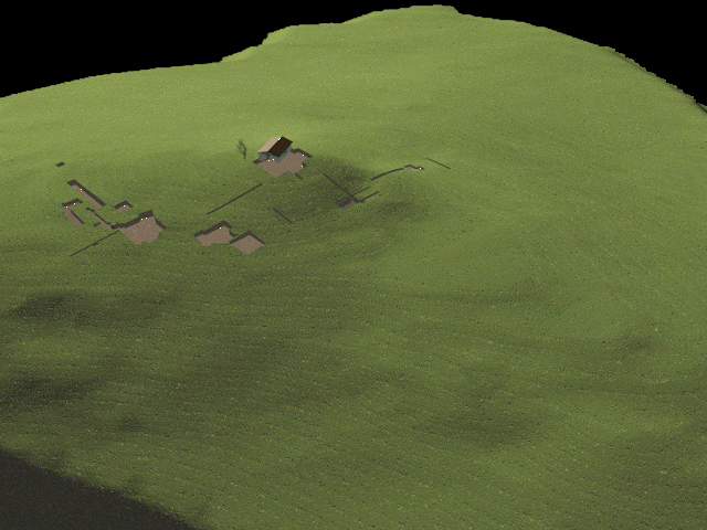
The preliminary terrain model (illustrated in the image below) shows
the hill of Tsoungiza with the trenches excavated by the NVAP field teams
from 1984 to 1986. The model and the location of the excavation units
are based on topographic plans drawn by Julia Pfaff. Further development
of the model will include: addition of the surrounding hills, deletion
of the Early Helladic house reconstruction, addition of vegetation based
on pollen analyses from the excavations, and higher resolution ground texture.
Data printed with permission of
the Nemea Valley Archaeological Project, Tsoungiza Excavations (for research
purposes only; data are not to be copied, retransmitted, or altered in
any way without written permission from Learning Sites, Inc. and the Director
of the Tsoungiza Excavations).
For further information
or to comment send messages to Learning
Sites or to the NVAP offices.
 The
Nemea Valley Archaeological Project
The
Nemea Valley Archaeological Project